Deliverables
- DTM and DEM
- Orthomosaic/ Contour Maps
- Volumetric calculations and reports
- LiDAR scans
- GIS maps.
Faster and more precise than traditional methods, drones capture high-resolution imagery and help generate detailed 3D models, revolutionizing industries like construction, mining, waste management and agriculture.
Deliverables
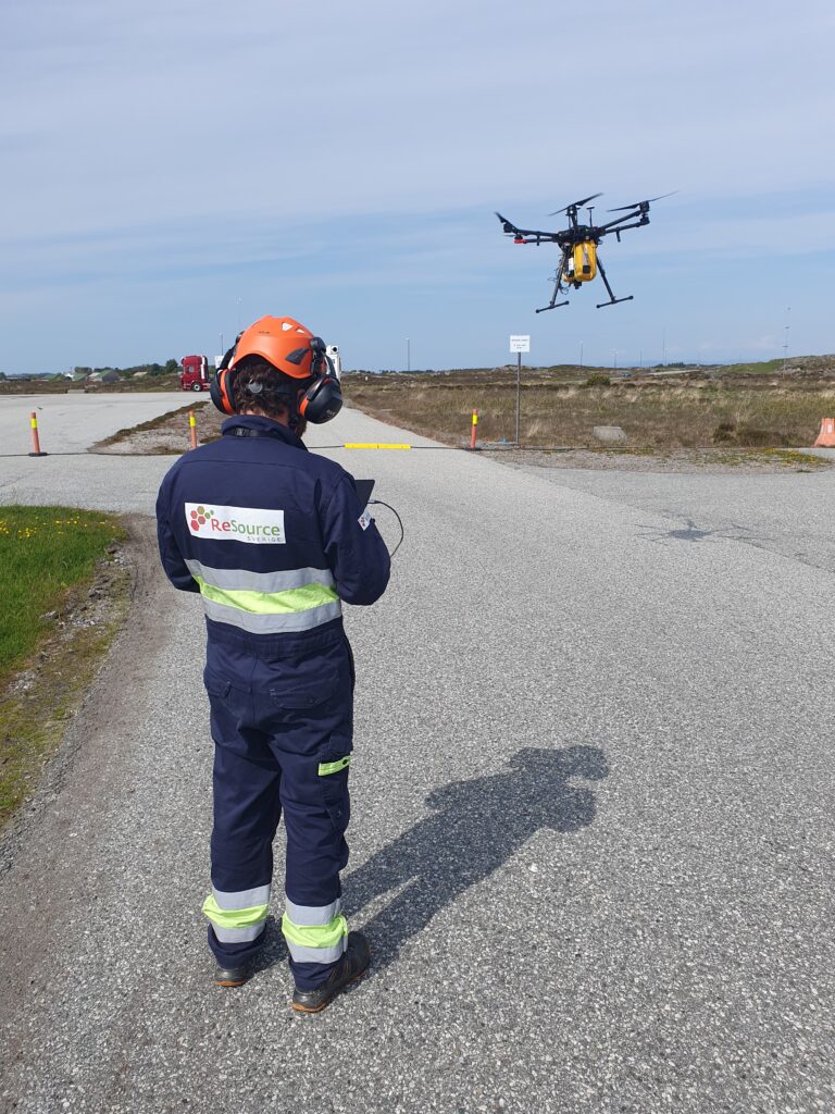
Drone-based land surveying, also known as UAV (Unmanned Aerial Vehicle) surveying, is a method of collecting geospatial data using unmanned aircraft equipped with specialized sensors and camera payloads. One of these innovative approaches combines the principles of photogrammetry with advanced GPS technology to create highly accurate maps, 3D models, and topographical surveys. In photogrammetry, the drone takes off and flies over a pre-programmed flight route or flown manually by a skilled and trained remote pilot. As it flies over the survey area, it captures hundreds or even thousands of overlapping images. These images, like pieces of a complex puzzle, are then stitched together using sophisticated software to create a comprehensive and precise representation of the surveyed area. A single, geometrically corrected image that covers the entire survey area is also known as orthomosaic.
The key components that transform a UAV into a powerful surveying tool include:
These components work together, each playing a crucial role in the data collection and processing pipeline. The result is a digital twin that provides unprecedented insights into the surveyed terrain.
UAV surveying dramatically reduces the time and manpower required for data collection. A project can often be completed in a matter of days or even hours with a drone where conventional remote-sensing technologies are either time-consuming or too costly. Benefits of drone-based surveying mainly involve:
Drone-based photogrammetry can achieve accuracy levels of 1 cm in both horizontal and vertical measurements, rivaling or even exceeding the accuracy of traditional GPS surveys. Our RTK drones contribute to enhanced survey accuracy. However, high-quality data collection relies on more than just advanced equipment. Selecting optimal atmospheric conditions and appropriate Ground Sample Distance (GSD) is critical to ensuring the accuracy and reliability of survey results. To maximize data quality, our workflow carefully considers environmental factors such as visibility, wind, precipitation and light conditions.
Here's a non-exhaustive list of the industries that are using our aerial mapping services:
Each of these sectors has found unique ways to leverage drone surveying, transforming their operations and workflows.
Regulatory compliance and safety are the foundation of our aerial operations. In the drone industry, this entails ensuring that operators adhere not only to unmanned aerial regulations but also to privacy and data protection laws, local municipal regulations, and other applicable directives.
Like any other drone operator following the directive EU 2019/947 within an EASA member state, we hold a drone operator license, allowing us to apply for cross-border operations in other member states. With the EU Drone license and current business setup we can fly in the EU and EEA, Switzerland, Iceland and Norway.
Our operational authorization, approved by the Swedish Ministry of Transport Authority, permits us to operate under the PDRA G02 scenario. Within this scenario we can fly drones in the Specific Category and request reserved airspace.
Depending on the projects we undertake, our operators may also hold additional certifications in fields such as health and safety, environmental management, and gas monitoring. That said, certifications alone do not define us. Our team is committed to continuous learning and development, staying at the forefront of emerging technologies and methodologies in the rapidly evolving field of UAV surveying.

In drone surveying, success relies not only on possessing the right tools but also on the expertise to utilize them effectively for consistently delivering high-quality results in daily operations. Below is a selection of the tools we use:
Surveying and mapping can be conducted using various methods (UAVs, aircraft, wheeled vehicles, pedestrians, etc.). We are competent in both ground and drone-based mapping. Some of the key land surveying services we provide include:
You’ve read about the potential of drones in land surveying and seen how it drives efficiency, reduces costs, and delivers improved geodata. Contact us to discover how drone-based services can elevate your organization, whether through precise mapping, detailed 3D models, or accurate geospatial data collection. Let’s explore how we can help transform your operations with our technical expertise.

Drone surveying offers faster data collection, higher resolution imagery, and safer access to hazardous or hard-to-reach areas. It reduces on-site disruption and enables frequent updates, allowing for better project monitoring and decision-making. High-accuracy data can be achieved using RTK-equipped UAVs, often surpassing traditional methods in precision and efficiency.
Drone-based photogrammetry using RTK technology can achieve accuracy down to 1 cm in both horizontal and vertical dimensions. While it doesn’t always replace traditional GPS surveys, it is often more efficient and equally accurate for many use cases, particularly when combined with ground control points and favorable environmental conditions.
Depending on project needs, deliverables may include orthomosaic maps, digital terrain models (DTM), digital elevation models (DEM), contour lines, volumetric reports, 3D models, LiDAR scans, and GIS-ready data layers. These outputs are tailored to industries such as construction, mining, agriculture, and waste management.
Yes, drone surveying is particularly beneficial for active sites due to its minimal disruption and rapid data capture. Drones can operate over dynamic environments without halting operations, making them ideal for ongoing construction, mining, and waste processing sites.
We use high-resolution cameras, multispectral sensors, LiDAR units, RTK systems for centimeter-level GPS accuracy, and IMUs for orientation tracking. The data is processed using advanced photogrammetry software such as Pix4D, SR Measure, and UgCS to generate precise and detailed outputs.
Drone surveying is commonly used in mining, construction, agriculture, energy, urban development, and environmental monitoring. It's especially useful for volumetric calculations, topographic mapping, planning, inspections, and progress tracking across large or complex sites.
Yes, our drone operations fully comply with EU Regulation 2019/947 and are authorized by the Swedish Ministry of Transport under the PDRA G02 scenario. Our certifications allow operations across EU/EEA countries, Switzerland, Iceland, and Norway, with a strong emphasis on safety and regulatory adherence.
We follow strict data protection protocols, including flight feasibility assessments, mission-specific legal reviews, secure data storage, and anonymization where needed. Privacy is a core concern, and we guide clients through potential legal constraints during planning.
While drones are powerful tools, they may not be suitable in restricted airspaces, poor weather conditions, or highly sensitive privacy zones. In such cases, we advise clients on alternative methods like ground-based surveying or satellite data.
Our workflow includes pre-flight planning, regulatory assessments, optimal timing for environmental conditions, data acquisition, processing, and delivery of georeferenced outputs. We also offer collaborative platforms for clients to access and monitor project progress in real time.

Alessandro Sarno runs ReSource Sverige AB as CEO and Co-founder. The company provides environmental monitoring solutions and consultancy within energy and waste management sectors. With a background from Lund University, he spearheads the application of innovative technologies like digital data platforms and drone-based methane monitoring. His versatile approach and commitment to transparency drive the company's expansion of data-driven environmental services across Sweden and Europe.