Precision agriculture:
Are UAVs revolutionizing farmers' work?

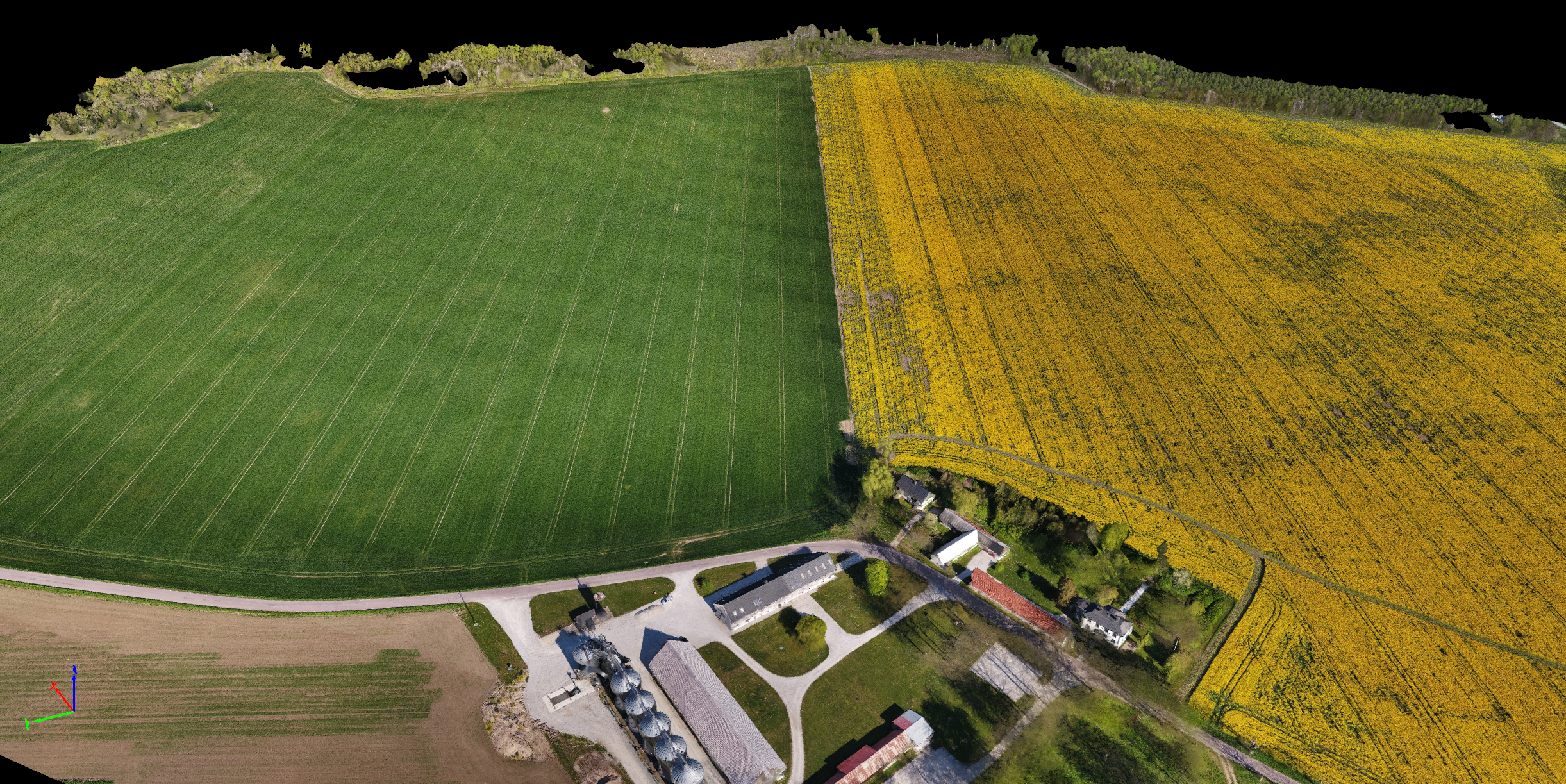
Advanced RGB and multispectral imaging cameras on drones offer an aerial view of crops, providing valuable insights into vegetation health, enabling more detailed productivity analysis, and helping farmers manage resources like water and fertilizers more efficiently.

How can drone imaging benefit your farm?

Drone technology is increasingly being used in agriculture. For instance, to accelerate vegetable breeding trials by capturing aerial imagery and automating data collection. These trials typically involve evaluating hundreds of breeding lines across diverse crops, such as leafy greens, root vegetables, and fruiting vegetables, to develop varieties with improved agronomic and quality traits. The process of creating new varieties, which traditionally takes years, is now being expedited by advancements in digital phenotyping. Drones enable the characterization of phenotypes, monitoring of growth rates, and measurements of uniformity across large-scale trials. This automated approach replaces manual inspections, reducing labor intensity while improving accuracy and objectivity. For this type of survey usually a resolution of 0,1 cm/pixel to 0,5 cm/pixel is required at a flight altitude of 5-20m AGL.

The data enhancement resulting from an increased image resolution gives the added value for further analysis. Key tools include advanced hardware and software capable of plant counting, growth analysis, and detailed trait measurement, such as plant size, disease resistance, maturity, color intensity, and plot density. These insights allow researchers to track changes over time and facilitate remote collaboration. Integrating drone-based phenotyping into agricultural practices demonstrates the potential of technology to transform traditional processes, making them faster, more efficient, and better suited to meet growing demands.

What deliverables can you expect?

We provide comprehensive, easy-to-understand results, offering a clear view of your crops and any identified issues. Here's what you can typically expect:

  • Inspection reports with detailed analysis of crop anomalies, including:
    • High-resolution multispectral images with annotations
    • Corresponding RGB images or videos for comparisons
    • Recommendations for further action and/or field investigations
  • Raw data for clients who wish to perform their own analysis on scans
  • Follow-up consultation to discuss potential causes of what you see in your field.

How do we produce high-quality imagery?

Determining the appropriate flight altitude for agricultural drones is crucial for obtaining high-quality imagery tailored to specific farming objectives. Flight altitude directly influences image resolution, data accuracy, and the effectiveness of subsequent analyses. 

The first metric to consider is Ground Sample Distance (GSD) which refers to the distance between the centers of two consecutive pixels in an image, representing the actual ground area covered by each pixel. A lower GSD indicates higher image resolution, capturing finer details essential for precise agricultural and plant assessments.

Then we consider the objective of the mission and what is the data needed for further crop analysis. Finding an optimal flight altitude is key to plan a field survey. For tasks like delineating field boundaries, high-altitude flights are sufficient since they require less detailed imagery, whilst activities such as evaluating emergence rates, conducting plant counts, assessing plant size, disease presence, density, and health necessitate higher resolution imagery. This requires flying at lower altitudes to achieve a GSD of less than 2 cm, ensuring detailed capture of individual plant characteristics. 

The payload and sensor specifications need to be reviewed to determine whether certain cameras, including panchromatic sensors, can capture high-resolution images at higher altitudes, or if standard RGB cameras are adequate for flying at lower altitudes to achieve the desired GSD. The lens focal length and sensor size affect image resolution, so understanding your camera's capabilities is key to determining the optimal flight altitude. For detailed assessments like plant counts or phenotyping, a GSD of under 2 cm is ideal, usually requiring flight altitudes between 15 to 40 meters AGL. For broader tasks like mapping field boundaries or assessing large areas, higher altitudes can be used, depending on the desired GSD and camera capabilities.

Examples of NDVI mapping

ReSource was involved in a study co-funded by SLU and Hushållningssällskapet Gotland which aimed at assessing whether UAV-based data capture could help making more informed decisions in crop cultivation and ensure the right measures are taken in the right parts of the fields. 

The idea was also to document and compare changes over time, identifying if specific growth phenomena occur annually or are unique to a particular season.

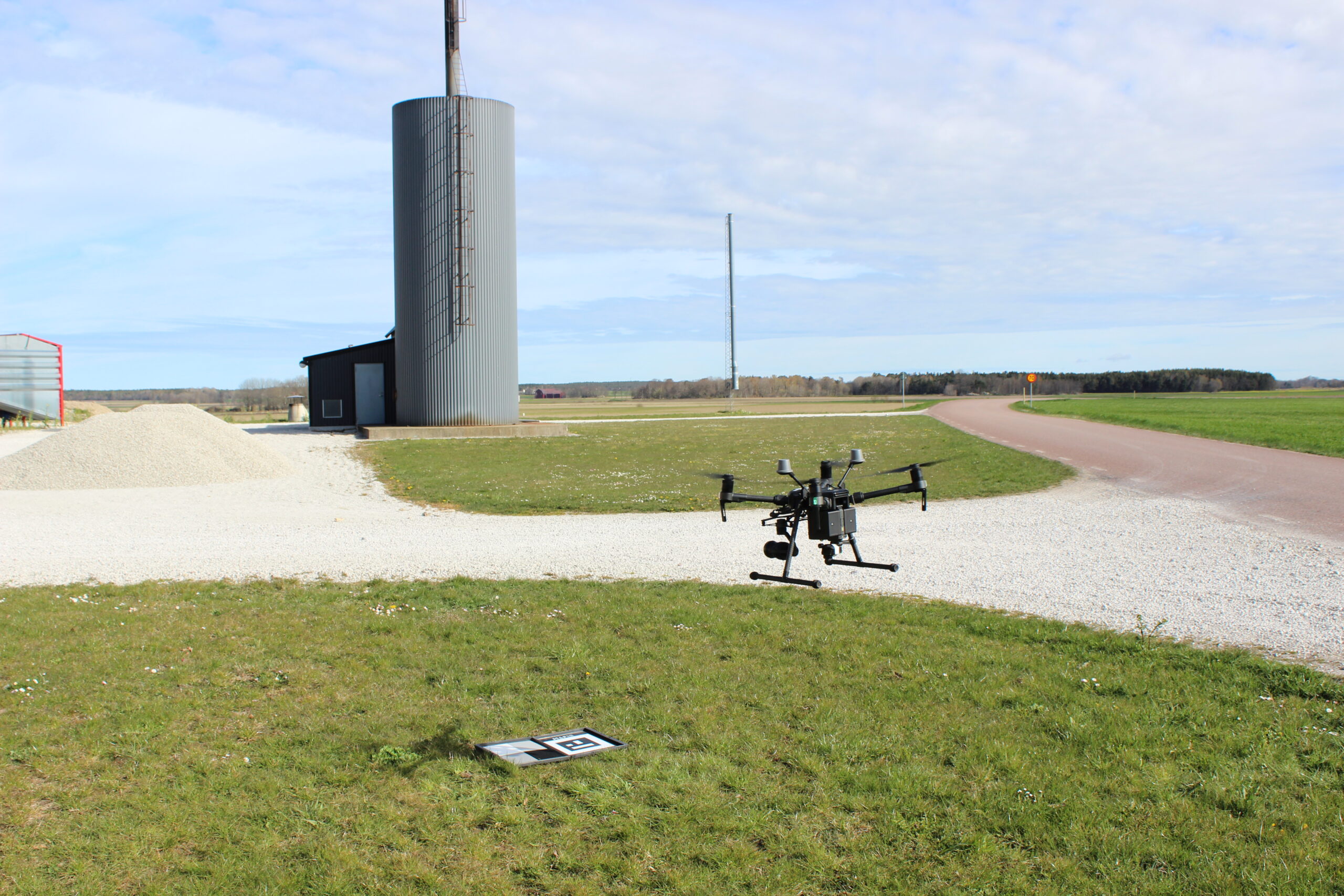
Drones were used to compare growth in crops, whose soil was established using four different methods. RGB cameras and NDVI sensors have been utilized to build orthomosaics through photogrammetry and measure vegetation status with infrared spectroscopy. The conclusion was that this technology, relatively new and underused in daily operations, has significant potential for improving agricultural productivity. SLU’s involvement has been important in validating its application under crop seeding .

Unlike satellite images, drone technology provides higher resolution and allows for detailed field analysis. The results are presented as maps and 3D models, or imported in digital platforms for long-term monitoring and advanced analysis. Drones equipped with multispectral cameras can complement other tools in identifying areas affected by factors such as drought. This ensures accurate decisions regarding fertilization and other actions.

Our UAV-based inspection workflow

The process starts with a consultation to understand your goals—whether it's improving vegetation health, monitoring growth and plant size over time, understanding disease resistance, or identifying anomalies in the soil. We then design a custom inspection plan to ensure the data we capture directly addresses your objectives.

Required preparation

Here is a checklist for performing a valuable map:

  • Site survey and/or analysis of available data
  • Flight planning based on all areas of interest
  • Weather check to ensure optimal flying conditions for the inspection
  • Equipment preparation
  • Coordination with on-site personnel and compliance with necessary safety protocols.

A meticulous preparation is important to ensure a successful data capture. 

How and why analysis and interpretation of drone data is important?

In conclusion, drone data analysis captures high-resolution images using RGB and multispectral cameras, offering valuable insights into crop health and growth. These images are processed with advanced software or AI tools to measure key factors like plant size, disease resistance, and field anomalies. For tasks such as plant counts or phenotyping, drones fly at lower altitudes to achieve a GSD under 2 cm for fine details. The processed images are then analyzed to generate actionable reports, including growth patterns, health assessments, and resource management suggestions. The success of drone technology in precision agriculture lies in transforming raw data into insights that drive better decisions, improve crop productivity, and optimize resource use, enhancing both productivity and sustainability in farming. Without accurate data interpretation, the full potential of drones in agriculture remains untapped. Thus, humans and field knowledge are and will always be needed. 

Wondering how drones can help your farm thrive?

You’ve learned about the potential of drones in precision agriculture and their ability to provide advanced insights into crop health and productivity. Reach out to discover how our drone-based services can enable precise management of resources like water and fertilizers, improving efficiency and sustainability through precise mapping, detailed multispectral surveys, or accurate plant counts. Contact us and let’s work together to transform your operations with our technical expertise.

Approved by
Alessandro Sarno

Alessandro Sarno runs ReSource Sverige AB as CEO and Co-founder. The company provides environmental monitoring solutions and consultancy within energy and waste management sectors. With a background from Lund University, he spearheads the application of innovative technologies like digital data platforms and drone-based methane monitoring. His versatile approach and commitment to transparency drive the company's expansion of data-driven environmental services across Sweden and Europe.

earth linkedin facebook pinterest youtube rss twitter instagram facebook-blank rss-blank linkedin-blank pinterest youtube twitter instagram